Peer-reviewed and applied remote sensing case studies across city, national, and global scales. All projects include reproducible methods and policy-ready outputs.
Selected Case Studies

Los Angeles - Multidecadal analysis of greenness and temperature spatial distributions and temporal changes. Published in 2023 in Urban Climate. https://doi.org/10.1016/j.uclim.2023.101743

In a study spanning 1990-2024 I used Landsat to compare 52 U.S. cities and their non-urban reference sites to determine the factors driving the changes from "urbanization." In Review at Landscape and Urban Planning.
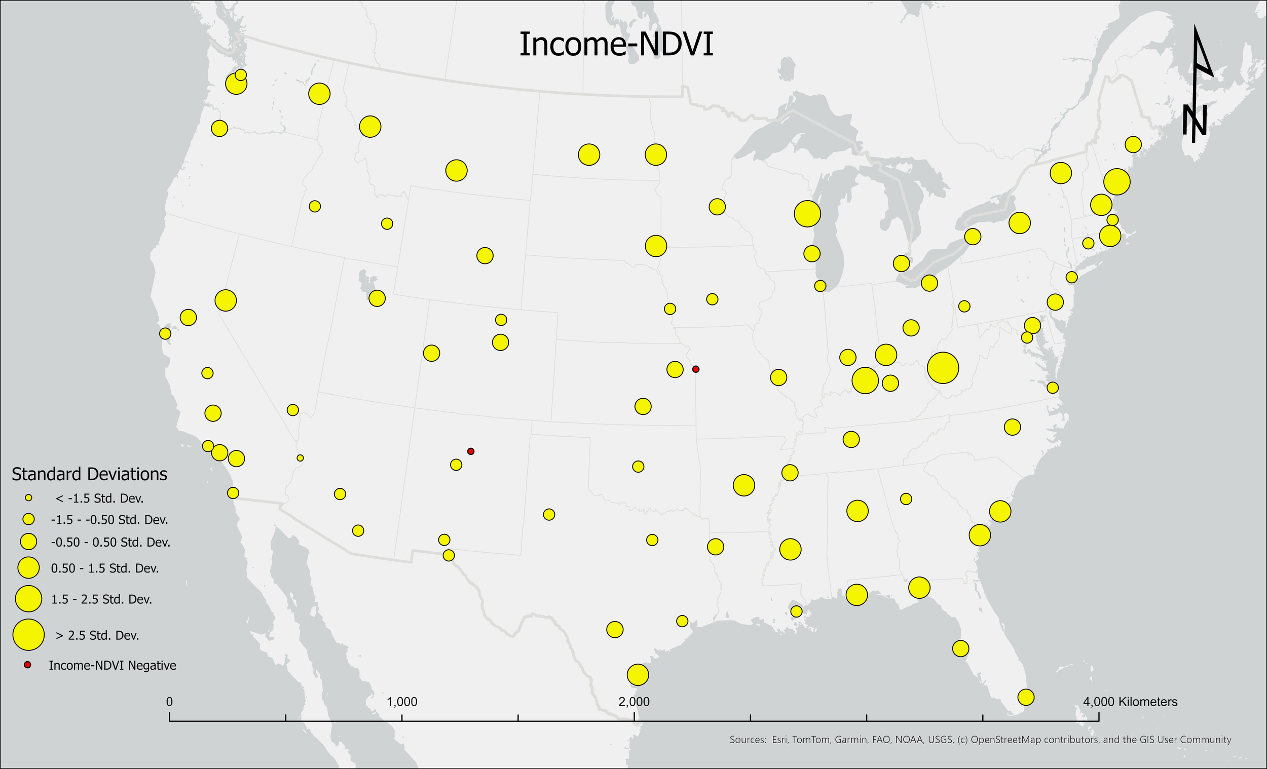
Figure shows the average income-NDVI relationship between 1990-2023. This was a national-scale analysis of the change in the luxury effect (the association between higher income neighborhoods being cooler and greener) in 87 U.S. cities from 1990-2023. We found a significant decline in the luxury effect, which reflects greater similarity through time in the greenness and temperature of high income and low income neighborhoods.

El Paso tree-priority project (ongoing/stakeholder)

Global urban greenness/temperature analysis of 311 cities from 1990-2024. We found a significant decline in the cooling provided by plants to cities.

National-scale urban fires research from 1985-2024. The attached image, centered over Malibu, CA, shows how many times each 30-meter urban pixel burned between 1985 and 2024.
More studies & research

Global analysis of the resistance and resilience of the arid lands of the Earth’s surface, using Landsat imagery resampled to 1 km resolution, from 1984-2023. Research ongoing.

Geospatial classification of invasive black mustard (Brassica nigra) distributions in Southern California. Planned/Ongoing.
A full list of peer-reviewed, published research is available on Google Scholar.